
Monitoring air pollutants is important to understand the impact of approach change.
Why air quality monitoring is essential
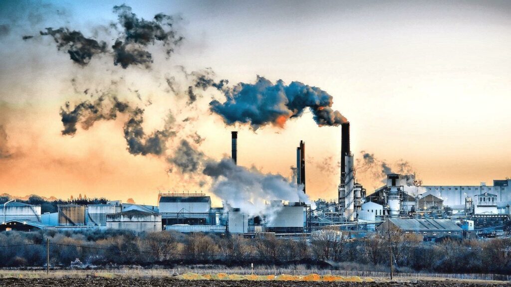
The starting point of air quality monitoring is to first study if an area has an air pollution problem. Monitoring helps in setting the level of pollution in relation to the ambient air quality standards. Standards are a regulatory measure to set the target for pollution reduction and achieving clean air. Robust monitoring helps to guard against extreme events by alerting people and initiating action. We handle a total of 12 pollutants, including SO2, NO2, PM10, PM2.5 (particulate matter of up to 10 microns and up to 2.5-micron size), ozone, lead, arsenic, nickel, CO, NH3, benzene, and BaP (particulate phase).
Across cities, only SO2, NO2, and RSPM / PM10 are monitored regularly. Other pollutants, such as PM2.5, O3, CO, BTX, heavy metals are monitored in select cities as capacity is still being built. India has set a target for states to meet National Ambient Air Quality Standards (NAAQS) in urban areas by 2017.

How accurate and absolute is the air quality data reported
The present national air quality monitoring network is limited in scope as the recorded values are indicative and there is an immense time lag in reporting the data. So real-time action is not possible. Also, the involvement of different monitoring agencies, personnel and types of equipment in sampling, chemical analyses and data reporting brings uncertainty and biases. But even with the current system, the non-compliance with standards in cities is found to be enormous. As many as 131 cities are exceeding the permissible limit for PM 10 and 18 cities are exceeding the permissible limit for NO2. Therefore, it is the action that matters even as we upgrade our monitoring systems.

Who carries out monitoring in India
The ambient air quality in India is monitored collectively by CPCB, state pollution control boards (SPCBs), pollution control committees (PCCs), and National Environmental Engineering Research Institute (NEERI) in cities, and covers 215 cities and towns. A total of 523 manual monitoring stations are being operated across states. Some states have set up additional monitoring stations in cities. However, there is a shortfall in operation as about 1,000 stations with additional continuous ambient air quality monitoring (CAAQM) stations, that report data in real-time, are required. As per the 2011 census, 46 cities have a million-plus population and in 16 cities CAAQMS have already been established and commissioned. The CAAQM stations collect the data of 8 pollutants, except metals and BaP.
Real-time monitoring results will help in calculating the air quality index to issue health advisories as well as for the formulation of an action plan to meet standards.
What plagues the current manual method
To ensure the quality of data, analytical quality control and following guidelines for monitoring and calibration, repair of instruments, and evaluation of ambient air quality monitoring stations are a must. But there are certain limitations to manual monitoring. Various measuring techniques and instruments give varying results on ambient concentration in the same location. Studies have found that average error ranges from 10 to 26 percent for PM monitoring, primarily because of incorrect flow measurement and calibration. Moreover, inconsistent power supply and voltage fluctuation affect monitoring. In the case of gaseous pollutants, duration of sampling, sample dilution, and temperature controls are essential to ensure that tests are done properly. Monitoring of benzene and O3 by the manual method has been found to be very difficult.
CAAQM’s sophistication deals with these issues, as it is a compact set-up of different pollutant analyzers and even calibration units. CAAQMS are provided with UPS along with backup capacity. But it costs quite a lot. The set of analyzers, calibrations systems, meteorological instrumentation, sensors, sampling lines, and display systems, among others, cost about Rs 90 lakh. Overhead and maintenance costs go up to Rs 10 lakh a year.
How many stations are sufficient?
Opinions differ on an appropriate grid density for capturing air quality profiles. Most experts agree that the current grid density is inadequate. The criteria followed in India requires that class I cities (cities with 100,000 population or more) should have a minimum of three stations each; megacities nine each; industrial areas should have about six and capital cities, six each.
An analysis of the National Ambient Air Quality Monitoring Programme (NAMP) data shows that 82 cities have only one station and 66 have two stations and about 80 class I cities do not meet the standard for monitoring stations. Big cities fare better. But do we increase the numbers with high investments? Given the resource crunch and limited technical skills in this field, many professionals advise against setting up elaborate monitoring systems. They suggest acting on the information currently available from the present network, instead. Setting up more stations should be evaluated based on where most people live, the pollutants they are exposed to, and the need for a daily alert system.
Weakest links in air quality management
Most SPCBs keep their special monitoring and surveillance efforts confined to industrial areas. Very few turn their awareness towards the urban air quality of cities. As a guide, what matters most is the ability of the authorities to understand the profile of a city’s air pollution sources and their emissions rates and trends; cities also must go beyond routine monitoring to generate specialized data. Unfortunately, Indian cities do not score on these counts.
How effective is satellite usage?
Satellite data can fill the coverage gaps in the existing network to support routine monitoring. They could also be used to identify potential air-grade hot spots. It has been found that using satellite data is more economical than setting up and operating a number of fixed stations. For instance, most of the NO2 in the atmosphere is contained within 1 km from the surface of the earth. That makes satellite measures useful representations of surface NO2 concentrations. For PM assessment, too, satellite-based assessment of aerosol optical depth is used. In summary, both the magnitude and spatial extent of sources can be determined and exposure can be assessed with the help of satellites.
Satellite observations can change what otherwise is known about emissions and concentrations observed through ground-based measurements. In a study in South Africa, a large difference between the calculated emissions values and actual values from the satellites was found, especially with respect to location and strength of emissions of sources.